Lone Tree, Colorado
Lone Tree, Colorado | |
|---|---|
| City of Lone Tree[1] | |
 Lone Tree Municipal Building | |
| Motto: "It's a great day to be in Lone Tree!" | |
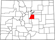
 Location of the City of Lone Tree in Douglas County, Colorado | |
Location of the City of Lone Tree in the United States | |
| Coordinates: 39°32′05″N 104°52′33″W / 39.53472°N 104.87583°W | |
| Country | |
| State | |
| County | Douglas County[2] |
| Incorporated | 1996[3] |
| Government | |
| • Type | Home rule municipality[1] |
| • City Council[4] | Mayor Jackie Millet Cathie Brunnick Mike Anderson Jay Carpenter Wynne Shaw |
| Area | |
| • Total | 25.10 km2 (9.69 sq mi) |
| • Land | 25.10 km2 (9.69 sq mi) |
| Elevation | 1,813 m (5,948 ft) |
| Population | |
| • Total | 14,253 |
| • Density | 570/km2 (1,500/sq mi) |
| Time zone | UTC-7 (MST) |
| • Summer (DST) | UTC-6 (MDT) |
| ZIP code[8] | 80124 |
| Area code(s) | Both 303 and 720 |
| FIPS code | 08-45955 |
| GNIS feature ID | 2410864[6] |
| Website | www |
The City of Lone Tree is a home rule municipality located in northern Douglas County, Colorado, United States. Lone Tree is a part of the Denver–Aurora–Lakewood, CO Metropolitan Statistical Area. The city population was 14,253 at the 2020 United States Census.[7]
Geography
[edit]Lone Tree is located on the northern border of Douglas County, directly adjacent to Arapahoe County. It is in the South Metro area of Denver, located 18 miles (29 km) south of Denver's downtown.
The city annexed the territory of the now-defunct University of Colorado South Denver's campus, the former site of The Wildlife Experience, in 2017.[9]
According to the United States Census Bureau, the city has a total area of 9.6 square miles (24.8 km2), all of it land.[10]
Demographics
[edit]| Census | Pop. | Note | %± |
|---|---|---|---|
| 2000 | 4,873 | — | |
| 2010 | 10,218 | 109.7% | |
| 2020 | 14,253 | 39.5% | |
| U.S. Decennial Census | |||
Transportation
[edit]Highways
[edit]Interstate 25 bisects the city, with access from four exits:
- Exit 192 (RidgeGate Parkway)
- Exit 193 (Lincoln Avenue)
- Exit 194 (Colorado State Highway 470/E-470)
- Exit 195 (County Line Road)
Colorado State Highway 470 (commonly known as C-470) also bisects the city and, in addition to the I-25 interchange, also provides access to Lone Tree via Yosemite Street.
Public transportation
[edit]The RTD Bus & Rail's E Line and R Line make five stops in Lone Tree (County Line, Lincoln, Sky Ridge Medical Center, Lone Tree City Center, and Ridgegate Parkway–the latter being the southern terminus of all three lines).
The Lone Tree Link operates free bus service along Park Meadows Drive during the weekdays, serving Lincoln Station and four other stops in the city.[11]
Amenities
[edit]Sky Ridge Medical Center and ER is situated in Lone Tree. Sky Ridge underwent extreme expansion efforts from 2013 to 2014. Sky Ridge contains a variety of hospital specialties and is located off of Yosemite near the Charles Schwab complex. For physical health and exercise, Lone Tree has the Lone Tree Recreation Center. The Recreation Center contains an indoor swimming pool, many gyms, and opportunities for classes.[12]
Lone Tree is home to Park Meadows. With over 185 stores and restaurants, it is Colorado's largest shopping mall.[citation needed] Park Meadows is built in the mountain lodge architectural style.[13] Although it is primarily an indoor mall, it also has an outdoor section called "The Vistas".[14]
Lone Tree is home to a large golf course and hotel area. Lone Tree is made up of many running trails and biking trails for inhabitants and visitors alike. The bluffs at the southern part of the city offer these trails as well as hiking possibilities. Lone Tree is approximately 30 minutes from Red Rocks, which offers more hiking, biking, and running trails as well as a venue for outdoor concerts. Additionally, its suburban location in South Metro Denver makes Lone Tree not far from Castle Rock, which offers other activities.[12]
Notable people
[edit]- Gitanjali Rao, scientist and Time magazine’s first Kid of the Year in 2020.[15]
See also
[edit]- Front Range Urban Corridor
- Denver-Aurora-Boulder, CO Combined Statistical Area
- Denver-Aurora-Broomfield, CO Metropolitan Statistical Area
References
[edit]- ^ a b c "Active Colorado Municipalities". State of Colorado, Colorado Department of Local Affairs, Division of Local Government. Retrieved January 27, 2021.
- ^ "Colorado Counties". State of Colorado, Colorado Department of Local Affairs, Division of Local Government. Retrieved January 27, 2021.
- ^ "Colorado Municipal Incorporations". State of Colorado, Department of Personnel & Administration, Colorado State Archives. December 1, 2004. Retrieved September 2, 2007.
- ^ "Council Members - City of Lone Tree". www.cityoflonetree.com.
- ^ "2016 U.S. Gazetteer Files". United States Census Bureau. Retrieved July 25, 2017.
- ^ a b U.S. Geological Survey Geographic Names Information System: Lone Tree, Colorado
- ^ a b United States Census Bureau. "Lone Tree city; Colorado". Retrieved April 25, 2023.
- ^ "ZIP Code Lookup". United States Postal Service. Archived from the original (JavaScript/HTML) on November 4, 2010. Retrieved November 15, 2007.
- ^ Mason, Stephanie (March 28, 2017). "Lone Tree annexes CU South Denver". Centennial Citizen. Retrieved June 26, 2018.
- ^ "Geographic Identifiers: 2010 Demographic Profile Data (G001): Lone Tree city, Colorado". U.S. Census Bureau, American Factfinder. Retrieved October 15, 2015.[dead link]
- ^ "Link On Demand". City of Lone Tree.
- ^ a b "Lone Tree, Colorado". weebly.com.
- ^ "Park Meadows". brookfieldproperties.com. Retrieved October 6, 2021.
- ^ "The Vistas at Park Meadows". Living in the Denver Suburbs. 2008. Retrieved December 4, 2020.
- ^ Time staff (December 3, 2020). "Meet TIME's First-Ever Kid of the Year". Time. Retrieved December 4, 2020.


